mail_outline sales@mediastorehouse.com
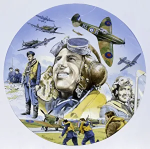
The Battle of BritainA circular painting depicting the brave men of the Royal Airforce on the ground and in action during the Battle of Briatin
Map of Lanzarote, Canary Islands, with soundings in fathoms. Date: 1835
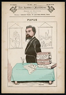
Papus / Gerard EncausseDR GERARD ENCAUSSE French occultist
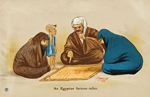
Egyptian Fortune TellerEgyptian street fortune teller has two women engrossed in his soothsaying
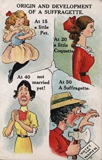
Suffragette Origin and Development. Charts the Origin and Development of a Suffragette. At 15 a little pet, At 20 a little Coquette, At 40 not married yet! At 50 a Suffragette Date: circa 1909
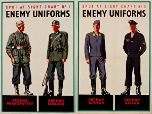
Two posters, Spot at Sight, Enemy Uniforms, WW2. German parachutist, soldier, airman and sailor. 1940s
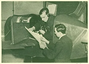
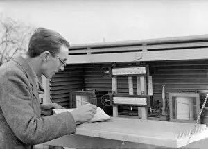
WW2 - R. A. F Pilot Receives His ChartsA photograph which portrays a British WW2 R.A.F. trainee pilot receiving the chart that records his flight. Date: circa 1940s
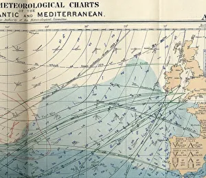
RMS Titanic - shipping chart of North Atlantic for the month of April 1912, Sheet 133, Meteorological Office, London. The chart is in colour and displays wind, sea current, sea temperature
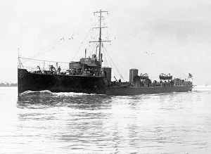
HMS Kale, E-class - River-class destroyerRoyal Navy - HMS Kale, a Hawthorn Leslie type River-class destroyer ordered under the 1903-1904 Naval Estimates and named after the Kale Water in the Scottish Borders
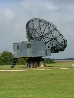
Wurzberg radar antenna Douvres Radar StationThis is just outside the Museum which is based in two well preserved bunkers and charts the evolution of radar. The dish, a Wurzberg-Reise, was removed after the war, renovated and returned here
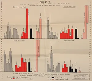
Poster, Chart II, growing vegetables, WW2Poster, Chart II, growing vegetables in winter and spring. 1940s
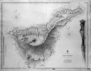
Map of Tenerife, Canary Islands, with soundings in fathoms. Date: 1838
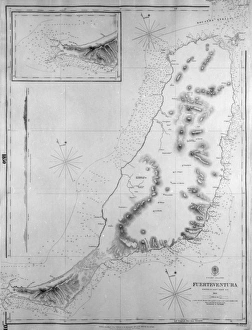
Map of Fuerteventura, Canary Islands, with soundings in fathoms. Date: 1835
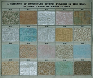
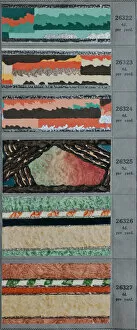
Background effects, SMB wallpaper sample bookA selection of background effects, with code numbers, in an SMB wallpaper sample book. Date: 1934
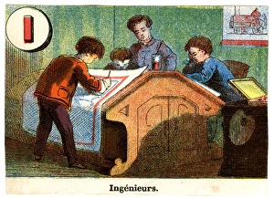
French Railway Alphabet - I for Ingenieurs (engineers). 19th century
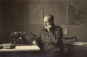
Soldier in an office, British Army of the Rhine, GermanySoldier in an office with charts and maps on the wall behind him, British Army of the Rhine, near Braunschweig (Brunswick), Lower Saxony, in postwar Germany. Date: circa 1946
Soldier in an office, British Army of the RhineSoldier in an office with charts and maps on the wall behind him, British Army of the Rhine, near Braunschweig (Brunswick), Lower Saxony, in postwar Germany. Date: circa 1946
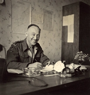
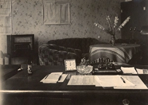
Officers desk, BAOR, Braunschweig, GermanyOfficers desk in an office with charts and maps on the wall, British Army of the Rhine, near Braunschweig (Brunswick), Lower Saxony, in postwar Germany. Date: circa 1946
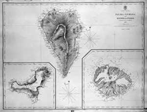
Map of Palma, Gomera and Hierro, Canary IslandsMap of Palma, Gomera and Hierro (or Ferro), Canary Islands, with soundings in fathoms. Date: 1837
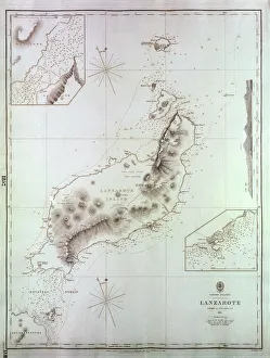
Map of Naos and Arrecife, Lanzarote, Canary IslandsMap of the ports of Naos and Arrecife, Lanzarote, Canary Islands, surveyed by the Spanish Navy in 1853, with outer soundings from a survey of 1835, updated in 1880. Date: 1881
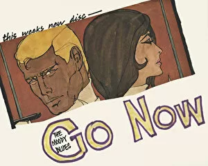
Poster, the Moody Blues new disc, Go NowPoster in strip cartoon style, advertising the Moody Blues new disc, Go Now. Released in late 1964, it reached the top of the charts in late January 1965. Date: circa 1964
Border designs, SMB wallpaper sample bookSix art deco style border designs in an SMB wallpaper sample book. Date: 1934
Weather ForecasterA weather forcaster analyses his temperature charts at Kew Observatory, near London, England. Date: early 1930s
Nautical atlas (Civitate Marsilia) by Francesc Oliva II, 1658. Made up of five papers. The first paper is a chart of the Mediterranean sea and the others are portolan charts. Issued in Marseille
Spencerian charts of writing. Date 1874 Jun. 3
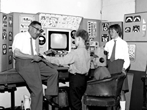
School teacher and pupils in filmmaking project, WaltonWalton-on-the-Naze Secondary School teacher Mr Lou Broom encouraged his pupils to learn various skills during the making of several award winning films
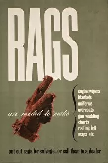
Poster requesting Rags for salvagePoster: request for Rags for salvage. Rags are needed to make engine wipers, blankets, uniforms, overcoats, gun wadding, charts, roofing felt, maps, etc
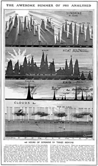
Analysis of the weather of 1911A chart analysing the extraordinarily hot weather experienced during the summer of 1911, which saw 660 hours of sunshine in three months. Date: 1911
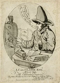
I. Calculator Esq: The Celebrated ConjurorCopy of illustration, " I. Calculator Esq: The Celebrated Conjuror" by A.B. 30 August 1776. HPG/8/2/1 (v)"
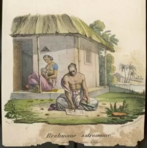
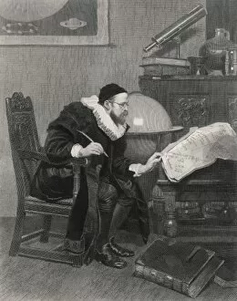
Indian AstronomerAn Indian Astronomer studies his charts
Astrologer at WorkAn astrologer charts a horoscope
Franklin / Trent in FloesLieutenant John Franklin on his first expedition: the Trent among ice floes which halted their expedition, although they did bring back some valuable charts
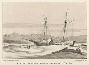
Franklin / Dorothea in IceLieutenant John Franklin on his first expedition: the Dorothea icebound not far from Spitsbergen. The expedition did bring back some valuable charts