mail_outline sales@mediastorehouse.com
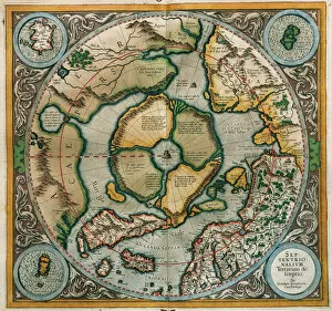
Septentrionalium Terrarum descriptio, 1595, by Gerardus MercGerardus Mercator (1512-1594). Flemish cartographer. Septentrionalium Terrarum descriptio. Map of the Arctic with the North Pole and surrounding lands within and outside the Arctic Circle, 1595
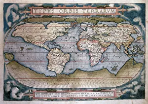
Theatrum Orbis Terrarum (Theatre of the World) by Abraham OrTheatrum Orbis Terrarum (Theatre of the World). Is considered to be the first true modern atlas. Written by Abraham Ortelius and originally printed on May 20, 1570, in Antwerp. World Map
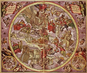
Andreas Cellarius (1596-1665). Dutch-German cartographer. Harmonia Macrocosmica, 1660, a major star atlas, published by Johannes Janssonius in Amsterdam
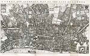
Map of the City of London by John Ogilby 1676. Ogilby (also Ogelby, Oglivie - 16001676) was a Scottish translator, impresario and cartographer
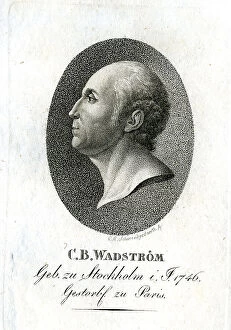
C B Wadstrom - Cartographer
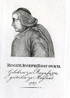
Roger Joseph Boscovich - Cartographer
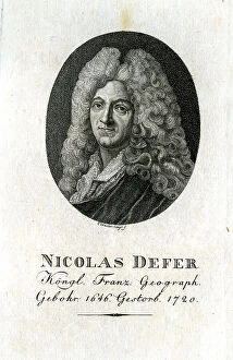
Nicolas De Fer - Cartographer
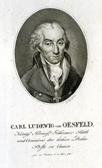
Carl Ludewig Von Oesfeld - Cartographer
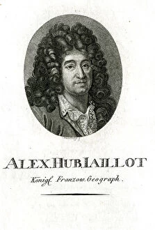
Alex Hub Jaillot - Cartographer
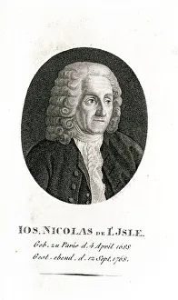
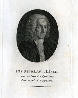
Ios Nicolas De L'Isle - Astronomer and Cartographer
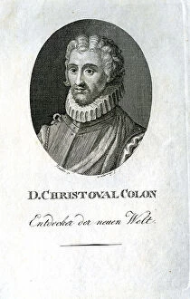
D Christoval Colon - Cartographer
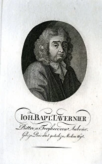
Ioh Bapt Tavernier - Cartographer
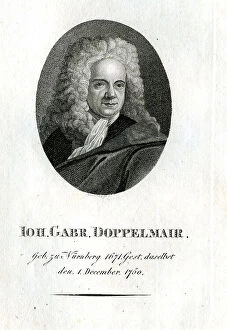
Ioh Gabr Doppelmeyer - Cartographer
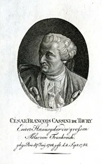
Cesar Francois Cassini De Thury - Cartographer
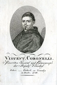
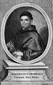
Vincent Coronelli - Cartographer
Gerhard Mercator - Cartographer
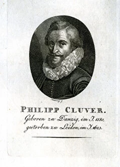
Philipp Cluver - Cartographer
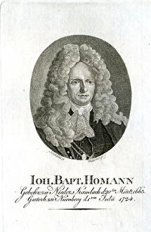
Ioh Bapt Homann - Cartographer
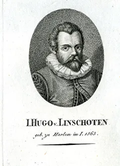
Hugo Linschoten - Cartographer
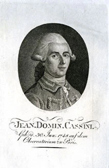
Jean Domin Cassini - Cartographer
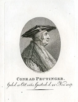
Conrad Peutinger - Cartographer
Ios Nicolas De L'Isle - Cartographer
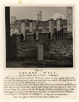
Part of the London Wall in the churchyard of St. GilesPart of the ancient London Wall in the churchyard of St. Giles, Cripplegate, London. Built in the third century, and repaired by London Mayor Ralph Joceline in 1477
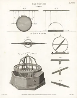
Plans and views of magnetic compasses with dipping needlesPlans and views of magnetic compasses, including the dipping needle built by Dr. John Lorimer (1732-1795), surgeon, mathematician, politician and cartographer
Colonel P H FawcettColonel Percy H Fawcett (1867 - 1925), British geographer, artillery officer, cartographer, archaeologist, and explorer of South America. 1932
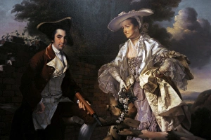
Peter Perez Burdett and his first wife Hannah, 1765, by JosePeter Perez Burdett (c.1734-1793). English cartographer and artist. Peter Perez Burdett and his first wife Hannah, 1765, portrait by Joseph Wright of Derby (1734-1794)
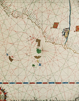
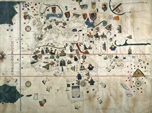
Portolan of Joan Martines (16th century). 1587. Map of the CPortolan of Spanish cartographer Joan Martines (16th century). Majorcal school. 1587. Map of the Canary Islands and the west coast of Africa. Messina, Sicily. National Library. Madrid. Spain
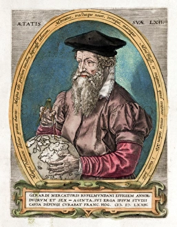
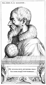
Gerardus MercatorGERARDUS MERCATOR Known also as Gerhard Kremer Flemish cartographer
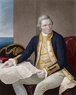
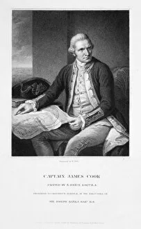
Captain James Cook - British explorer, captain and navigatorCaptain James Cook - British explorer, navigator, cartographer, and captain in the Royal Navy (1728-1779). Date: 1776
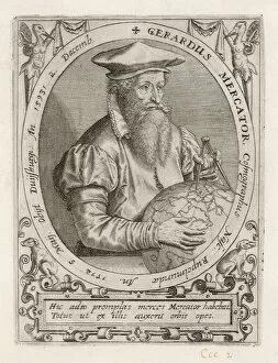
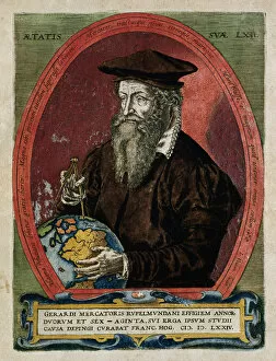
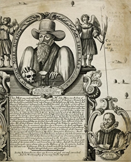
Portrait of Mercator with globe and compassTitle page illustration from Theatrum Geographiae Veteris, an early large-scale world Atlas by Pertius Bertius, printed in Amsterdam 1618-19 showing the great cartographer Mercator Date: 1618
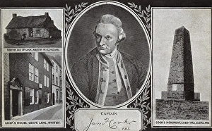
Captain James Cook - Explorer - Portrait and Notable PlacesCaptain James Cook (1728-1779) - British explorer, navigator, cartographer, and captain in the Royal Navy - portrait and notable places associated with his life - his birthplace at Marton in
Portolan of Joan Martines (16th century). American west coasPortolan of Spanish cartographer Joan Martines (16th century). Majorcan school. American west coast (Peru, Ecuador and Colombia). 1587 Messina, Sicily
Juan de la Cosa (1460-1509). Spanish navigator and cartographer. Portrait
Chart by Juan de la Cosa (1450-1510). Spain. Madrid. Mavy Museum
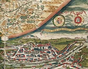
Salzburg and surroundings. Theatrum Orbis Terrarum by AbrahaView of Salzburg and surroundings. Theatrum Orbis Terrarum by Abraham Ortelius (1527-1598). First Edition. Antwerp, 1574. Library of Catalonia. Barcelona. Spain
Ramon de Jaudenes y Alvarez (1841-1884). Spanish military and cartographer. Their destinations were, Tetuan, Puerto Rico, Cuba and Ceuta. Engraving. La Ilustracion Espanola y Americana, 1884. Colored
Gerardus Mercator (1512-1594). EngravingGerardus Mercator (1512-1594). Flemish cartographer. Engraving, 1595
Vespucci, Amerigo (1454-1512). Italian navigator, explorer and cartographer. Colored engraving. Cover of the German translation of the letter of Amerigo Vespucci to Lorenzo Pietro Pierfrancesco de
Vincente Maria CoronelliVINCENTE MARIA CORONELLI Venetian mathematician, geographer and cartographer (an important job for a trading nation like Venice) Date: 1650 - 1718
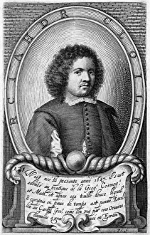
Richard CollinRICHARD COLLIN French geographer, cartographer and mathematician. Date: 1627 - ?
James King and James Cook - served in the Royal NavyJames King (1750-1784), british officer of the Royal Navy and the navigator and astronomer for Captain Cook (1728-1779), a British explorer, navigator, cartographer, and captain in the Royal Navy
ALCALA GALIANO Y DE ALCALA, Dionisio (1760-1805). Spanish naval officer, cartographer, and explorer. Litography
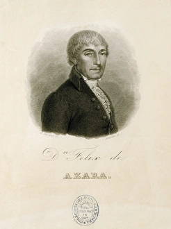
AZARA, F鬩x de (1746-1821). Spanish explorer, naturalistAZARA, F鬩 x de (1746-1821). Spanish explorer, naturalist, engineer and cartographer. Engraving. SPAIN. MADRID (AUTONOMOUS COMMUNITY). Madrid. National Library
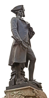
Captain James CookBritish Admiralty memorial statue of Captain James Cook (1728-1779) who made maps of Newfoundland before his 3 journies on the Endeavour to the Pacific where he discovered Australia
John More, clergyman and cartographerJohn More (?-1592), Fellow of Christs College, Cambridge, minister of St Andrews Church, Norwich, and cartographer. He worked for many years on a map of Canaan, based on biblical research
Charles PreussCHARLES PREUSS German-born cartographer, botanist and artist in America, working with Fremont to make important maps of the newly-explored West. Date: 1803 - 1864
Augustin HirschvogelAUGUSTIN HIRSCHVOGEL German artist, mathematician and cartographer, born at Nurnberg, died at Vienna. Date: 1503 - 1553
Captain James Cook (1728-1779)Portrait of Captain James Cook, an English explorer, navigator and cartographer. From a painting by Sir Nathaniel Dance