mail_outline sales@mediastorehouse.com
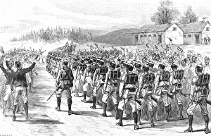
44th Gurkha Light Infantry leaving Shillong, Assam, 1891Engraving showing the troops of the 44th Gurkha Light Infantry, of the British Army, leaving Shillong, Assam Frontier, for an expedition to Manipur, 1891
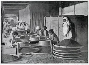
Sifting Tea in Assam, IndiaBritish Empire multiplied the tea gardens in north-east corner of India due to demand in Britain. Photograph showing one of the many processes of sifting the tea prior to packing. Date: late 1890s
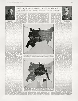
Story of the Bengal Partition and its reversalPage from The Graphic showing two maps of North East India. The top map shows Bengal partitioned in 1905, when a large part of its former area in the east was united with Assam to form the new
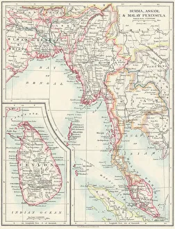
Map of Burma, Assam, Malay Peninsula and Ceylon Date: circa 1910
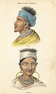
Man and woman of the Garrow people, Indo-ChineseMan and woman of the Garrow people in bandana, hoop earrings and necklaces. Indo-Chinese tribe from east of the Brahmaputra River, Indo-China
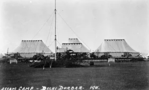
Assam Camp, Coronation Durbar, Delhi, IndiaThe Assam Camp at the time of the Coronation Durbar ceremony in Delhi, India, December 1911. Date: 1911
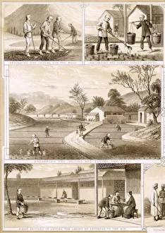
Assam tea industry in IndiaIndia - Various aspects of tea cultivation in the state of Assam. Date: circa 1870
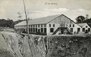
Cachar and Sylhet tea factory, Barak Valley, Assam, India. Date: circa 1910