mail_outline sales@mediastorehouse.com
Falkland Islands Royal Engineer briefing map, 1982 (c); with typescript annotations relating to the condition and passibility of airfields, roads and tracks by tracked and wheeled vehicles
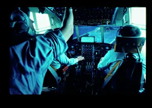
Flight simulator in use, RAF Lyneham, WiltshireA flight simulator in use at RAF Lyneham, Wiltshire. Before computers, flight simulators used actual models of different airfields in order to train pilots
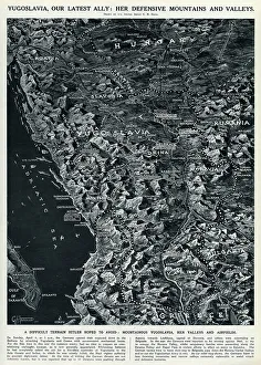
Map of Yugoslavia by G. H. DavisMap of Yugoslavia, Britains latest ally in the Second World War: her defensive mountains and valleys. Mountainous Yugoslavia, her valleys and airfields. Date: 1941
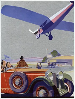
FLIGHT / AIRFIELDA light aeroplane comes in to land over the heads of watchers in a car Date: 1935
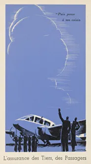
WAVING AS PLANE LEAVESWaving to passengers on a plane just about to take off
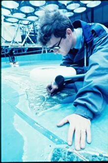
Creating model for flight simulator, RAF Lyneham, WiltshireMan working on a model for a flight simulator for use at RAF Lyneham, Wiltshire. Before computers, flight simulators used actual models of different airfields in order to train pilots
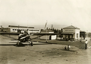
Air Filling Station 1929Located on the highway beside Los Angeles Metropolitan Airport, this service station caters for vehicles on the highway and also for aircraft using the airfield Date: 1929
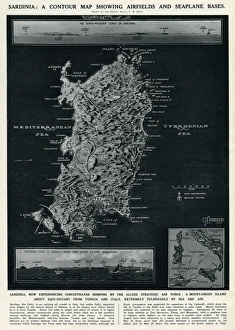
Map of Sardinia by G. H. DavisA contour map of Sardinia, showing airfields and seaplane bases during the Second World War. The island was experiencing concentrated bombing by the Allied Strategic Air Force. Date: 1943
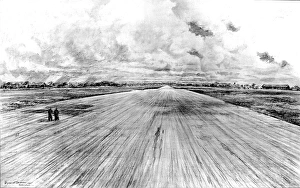
Podlington Airfield, Britain, 1945Drawing showing the huge deserted runway of Podlington airfield; formerly used by the US Eighth Air Force as a base for their raids on Germany, 1945
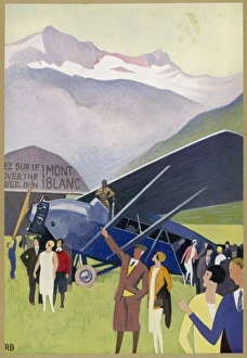
France / Alps / Flights 1931Passy, an airfield in the French Alps, is the point of departure for sightseeing flights over Mont Blanc
A French Airfield 1922Spectators flinch as a biplane flies uncomfortably close to them on a French airfield