mail_outline sales@mediastorehouse.com
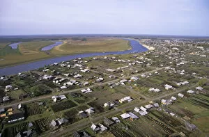
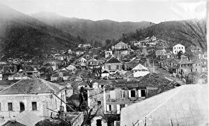
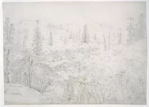
Russian village Garyi stretching along the river Sosva bank. North Ural Mountain region, Russia. traditional wooden houses and vegetable gardens, meadows and forest. September
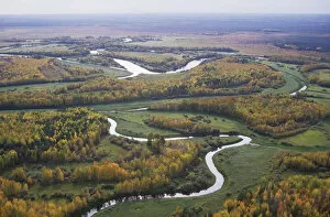
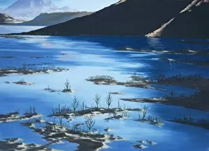
River Sosva meanders, forest and meadows (used for hay-making and transporting by the river). typical in North Ural Mountains region, Russia
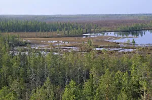
Taiga-forest and marshes near river Taz. North Tumen region, Siberia, Russia
RAINBOW - Kenya. Africa
RUSSIA - semi-tundra. Lakes and melting snow, aerial. Taiga near Norilsk town, Russian Arctic
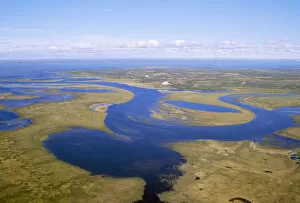
RUSSIA - semi-tundra aerial view of taiga. River near Pyasina Lake, Russian Arctic
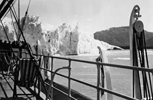
Alaskan IceburgA typical scenic view of the coast of Alaska, U.S.A. showing an iceberg and Fjord (right). Date: 1930s
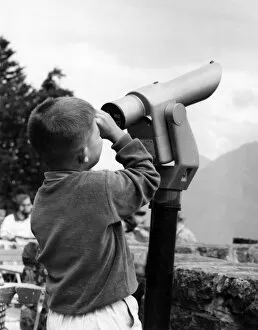
Boy Using a TelescopeA boy pays to use a telescope at a scenic spot. Date: late 1960s
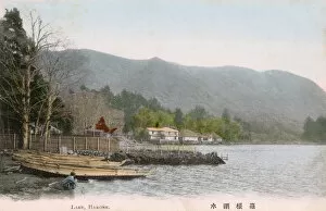
Lake Ashi, Kanagawa Prefecture, Honshu, JapanLake Ashi (Hakone Lake or Ashinoko Lake) - a scenic lake in the Hakone area of Kanagawa Prefecture in Honshu, Japan. Date: circa 1910s
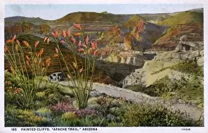
Painted Cliffs - Apache Trail - Arizona, USA. The Apache Trail is known as the greatest scenic highway in America, 120 miles long between Phoenix and Globe
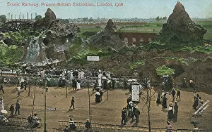
The Scenic Railway - Franco-British Exhibition, LondonThe Scenic Railway - Franco-British Exhibition, White City, London Date: 1908
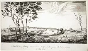
View across Sydney Cove from the hospital towards GovernmentDrawing LS 6 from the Watling Collection titled Taken from the West side of Sydney Cove behind the Hospital by Thomas Watling, 1792-1797
View of Sydney Cove from the North shore of the harbourDrawing LS 7 from the Watling Collection titled A Direct North View of Sydney Cove and Port Jackson, the Chief British Settlement in New South Wales by Thomas Watling, 1792-1797
Charlotte Amalia, St. Thomas, West Indies after a hurricaneA photograph taken during the voyage of H.M.S. Challenger (1872-1876), funded by the British Government for scientific purposes
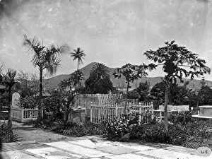
Cemetary, St. Thomas, West Indies (1873)The Voyage of H.M.S. Challenger (1872-1876) funded by the British Government for scientific purposes and seems to have been the first expedition to carry an official photographer as well as an
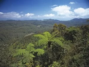
Upper montane rainforest, Sri LankaView looking north from Pattipola road to Horton Plains National Park, Sri Lanka
Horton Plains National Park, Sri Lanka
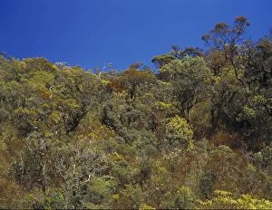
Montane rainforest canopy, Sri LankaView of montane rainforest canopy, The Peak Wilderness between Balangoda and Bogowantalawa, Sri Lanka
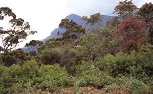
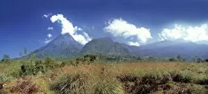
Adams Peak, Sri LankaA view of Adams Peak from the Nuwara Eliya area, Sri Lanka
Proterozoic Ice Age
Silurian landplantsAn artists impression of the the earliest vascular plants which developed beside freshwater pools during the Silurian (443 to 417 million years ago)
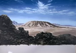
Precambrian LandscapeArtists impression of a Precambrian (4, 500 to 543 million years ago) landscape, when oxygen built up in the atmosphere (about 1)
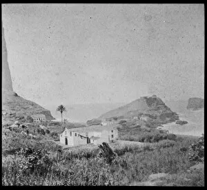
Jezirat Halaniya, OmanJezirat Halaniya in the Kuria Muria Islands, the island group off the southeast coast of Oman. Photograph held in the John Murray Collection, the Natural History Museum, London. Z MSS SEW A74
View looking across Sydney Cove towards the wooded north shoDrawing LS 9 from the Watling Collection titled South View of Sydney-Cove, taken from the General Spring nigh the Eastern entrance to Pitts Row by a Port Jackson Painter, 1788-1797
Norfolk Island drawing 4A sketch taken from Botanical Drawings from Australia by Ferdinand Bauer (1760-1826)
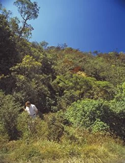
Scientist in Sri LankaFred Naggs searching for land snails in low vegetation in an area of montane rainforest close to Nuwara Eliya, Sri Lanka. The trip to Sri Lanka was part of a programme funded by the Darwin Initiative
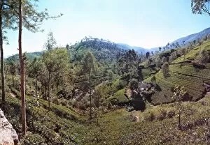
Tea fields, Sri Lanka
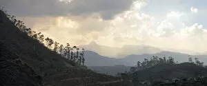
Adams Peak ridge, Sri LankaThe Adams Peak ridge from Gilimale, north of Ratnapura, Sri Lanka
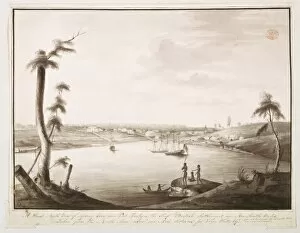
Port in Madeira 1873A photograph taken during the voyage of H.M.S. Challenger (1872-1876), funded by the British Government for scientific purposes
Riverston, Sri LankaView looking east from the Laggala Illukkumbura road at Riverston, Sri Lanka
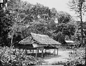
Native Houses, Wokan, Arru Islands, IndonesiaA photograph taken during the voyage of H.M.S. Challenger (1872-1876) funded by the British Government for scientific purposes
Coal mine at Sandy Point, Strait of MagellanA photograph taken during the voyage of H.M.S. Challenger (1872-1876) funded by the British Government for scientific purposes
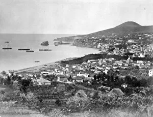
View of Madeira, Portugal, c. 1870A photograph taken during the voyage of H.M.S. Challenger (1872-1876) funded by the British Government for scientific purposes
The Diadem, Tahiti, Society Islands, c. 1870
Photograph of coral from the Yonge collection
Native canoe off the coast of FijiA photograph taken during the voyage of H.M.S. Challenger (1872-1876) funded by the British Government for scientific purposes
View to Harbour down dry stream bed. South AfricaA photograph taken during the voyage of H.M.S. Challenger (1872-1876) funded by the British Government for scientific purposes
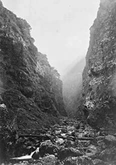
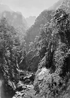
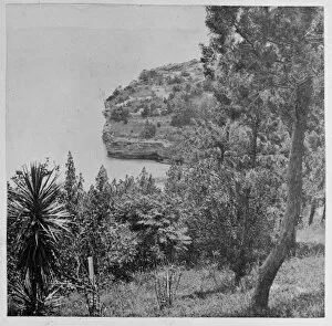
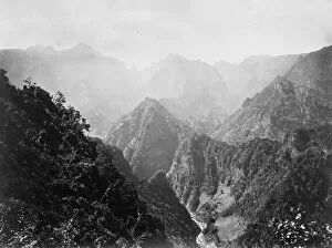
Mountain gorge, Madeira, Portugal, c. 1870A photograph taken during the voyage of H.M.S. Challenger (1872-1876) funded by the British Government for scientific purposes
Bridge and road in rural landscapeA photograph taken during the voyage of H.M.S. Challenger (1872-1876) funded by the British Government for scientific purposes
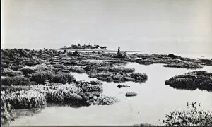
Coastal sceneryA photograph taken during the voyage of H.M.S. Challenger (1872-1876) funded by the British Government for scientific purposes
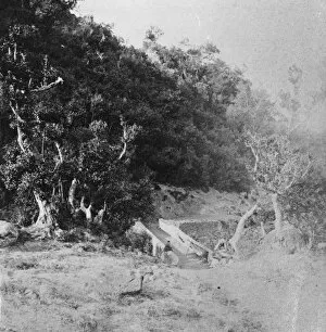
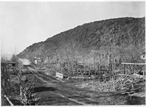
Damaged structures, possibly by stormA photograph taken during the voyage of H.M.S. Challenger (1872-1876) funded by the British Government for scientific purposes
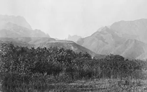
Mountains, Madeira, Portugal, c. 1870A photograph taken during the voyage of H.M.S. Challenger (1872-1876) funded by the British Government for scientific purposes
View along coast. Cape Verde IslandsA photograph taken during the voyage of H.M.S. Challenger (1872-1876) funded by the British Government for scientific purposes
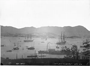
Harbour, Hong KongA photograph taken during the voyage of H.M.S. Challenger (1872-1876), funded by the British Government for scientific purposes
Harbour near Shameen Island, Canton, ChinaA photograph taken during the voyage of H.M.S. Challenger (1872-1876) funded by the British Government for scientific purposes
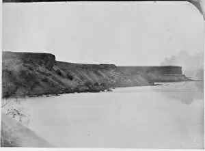
Coastal landscapeA photograph taken during the voyage of H.M.S. Challenger (1872-1876) funded by the British Government for scientific purposes
Cape Verde IslandsA photograph taken during the voyage of H.M.S. Challenger (1872-1876) funded by the British Government for scientific purposes
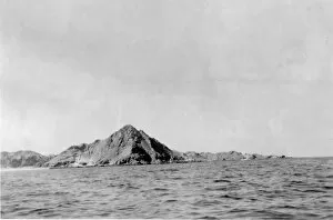
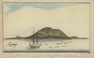
Raper drawing No. 28Hummock Island, so named by Captain Carteret - by the natives call d Mondooroo by George Raper 1791