mail_outline sales@mediastorehouse.com
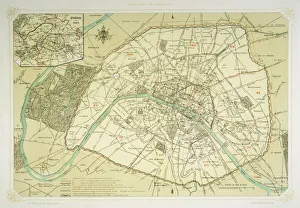
Map / Europe / France / ParisMap showing the growth of Paris from its earliest origins to the latest projects under Napoleon III
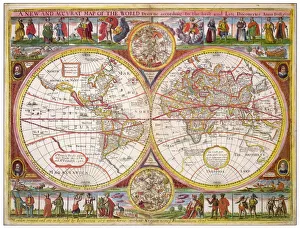
Overton World Map / 1670A new and accurate map of the world drawn according to the best and late discoveries of 1670
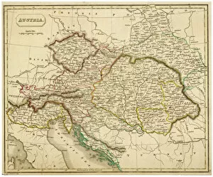
Map / Europe / Austria 1857Map of the Austrian Empire
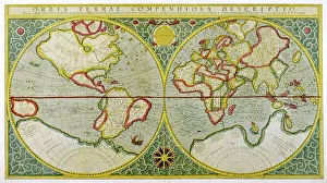
Mercator / World Map / 1587A map of the world by Gerhard Mercator
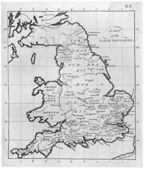
Map / Britain / Saxon PeriodMap of England and Wales showing kingdoms of Saxon heptarchy
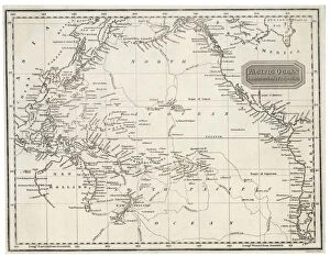
Maps / Australia 1850SMap showing the location of the GOLDFIELDS, so presumably made fairly soon after the start of the Australian Gold Rush in 1851
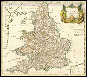
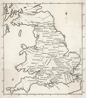
Map / England & Wales 1810England and Wales
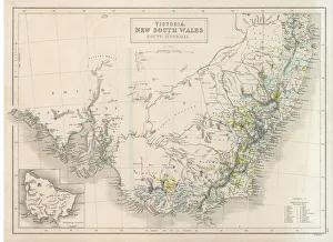
Maps / Australia 1854Victoria, New South Wales, South Australia
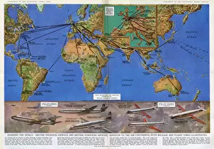
Mileage and flight times across the world, 1961 by GH DavisA map of the world together with various aircraft from British overseas airways and British European airways services to all six continents with mileage and flight times illustrated. Date: 1961
Roman Stations MapA map depicting the network of Roman settlements in Britain
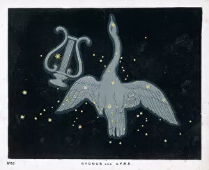
Blunt / Cygnus & Lyra / Pl32The constellation of Cygnus - a flying swan - and Lyra - that of an ancient Greek lyre
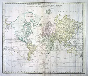
MAPS / WORLD / 1894World map showing the European colonies
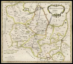
Map / Huntingdonshire 1810Map of Huntingdonshire
Map / England & Wales 1857Map of England and Wales showing roads and rivers Date: circa 1857
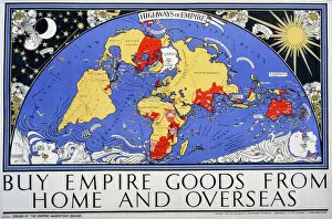
Empire map of the world
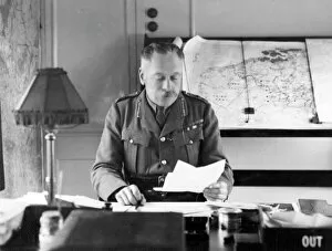
Sir Douglas Haig in his headquarter train, FranceField Marshal Sir Douglas Haig (1861-1928) in his headquarter train in France during the First World War, with maps of France and Belgium behind him. Date: circa 1918
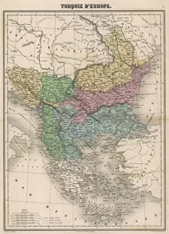
Map / Europe / Balkans C1850The Turkish-occupied territories in Europe, comprising all the Balkans apart from Greece
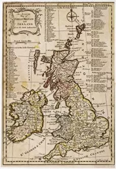
MAPS / BRITAIN / 1763An accurate map of Great Britain and Ireland from the best authorities
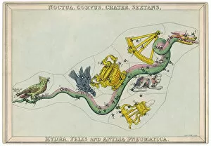
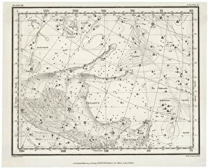
Hydra Star MapHydra constellation, including an owl, a raven and a sextant
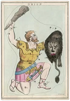
Orion Star MapOrion, giant hunter, clubbing a lion. Being slain by Diana, he was made one of the constellations and is supposed to be attended with stormy weather
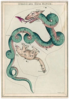
Ursa Minor Star MapDraco and Ursa Minor constellation
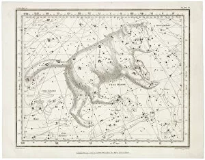
Canis Major Star MapCanis Major (dog) and Lepus (hare) constellation
Map / North America 1702Map of North America
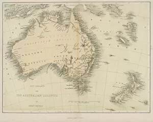
Map / Australia / Nz 1862Map of Australia and New Zealand
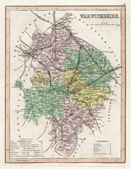
Map / Warwickshire C1857Map of Warwickshire
Map / W Indies / HispaniolaThe island of Hispaniola, now occupied by Haiti to the west, the Dominican Republic to the east
Map of Peru 1683 MalletPerou. A map showing a coastal part of South America on the South Pacific. Both the equator and tropic of Capricorn are given
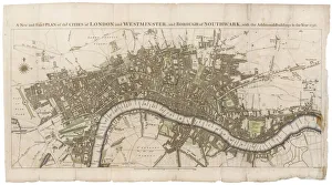
London Map 1756London still surrounded by fields, with Tyburn (note the gallows) and Buckingham House on the outskirts. Trafalgar Square doesn t exist, and Mayfair is still undeveloped
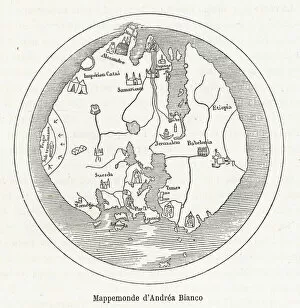
15th century World Map according to Andrea Bianco
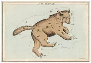
Ursa Major Star MapThe constellation of Ursa Major
Map of the WorldThe World, showing Captain James Cooks voyages from 1768 - 1775, based on Mercators Projection, published by William Faden 1778 Date: 1778
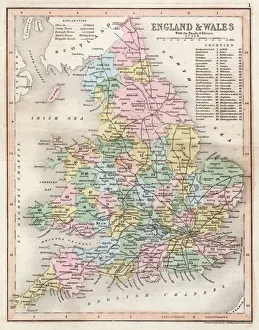
Map / England & Wales 1809ENGLAND AND WALES Hand coloured engraving
The Arrow Star MapThe Arrow constellation, showing Antinous being attacked by an eagle and also including a dolphin
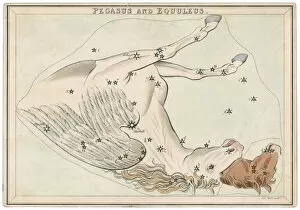
Pegasus Star MapThe Pegasus and Equuleus constellation
Map / Europe / France 1827Map of France showing the departements
Whittaker Star Maps 12Including Pegasus
Whittaker / Ursa MajorIncluding the Ursa Major
Maps / Pacific OceanMap of the Pacific Ocean on Mercators projection
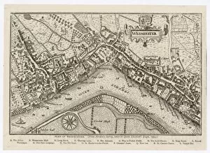
Map of Westminster, 1593Map of Westminster, London, 1593
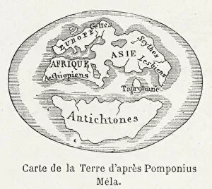
World Map c. 50ADWorld Map as known to Pomponius Mela, Roman geographer
Map of Europe in 1360A map of Europe in 1360, showing the boundaries of the Holy Roman Empire
GPO map of Mail Steamship Routes. Date: circa 1950s
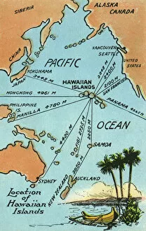
Map of Hawaii, Pacific Ocean and surrounding areasMap of Hawaiian Islands, Pacific Ocean and the surrounding areas. 1911
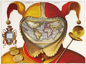
16th century red and yellow Jesters Cap costume map of the world16th century Jesters Cap map of the world 1590
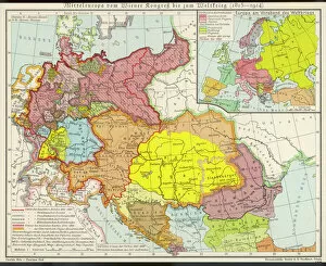
Middle Europe MapMap of Middle Europe from after the Vienna Congress until the start of World War I (1815 - 1914)
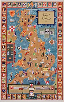
Poster, Map of Royal Britain. 1957
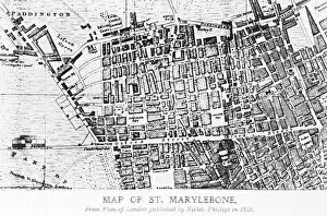
Map of St Marylebone, LondonMap of St Marylebone, from a plan of London published by Richard Phillips. Date: 1813
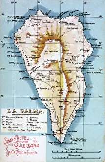
Map of La Palma, Canary Islands. Date: circa 1908