mail_outline sales@mediastorehouse.com
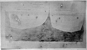
Chart of oceanic section, Tristan D Acunha to Cape of Good HA photograph taken during the voyage of H.M.S. Challenger (1872-1876) funded by the British Government for scientific purposes
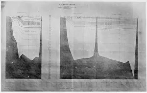
Chart of oceanic section, Halifax, BermudaA photograph taken during the voyage of H.M.S. Challenger (1872-1876) funded by the British Government for scientific purposes
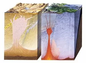
Origin of Gem MineralsA diagram showing cross sections through the earths continental crust to a depth of 40kms. Many gemstones form within the crust at different levels and at different temperatures
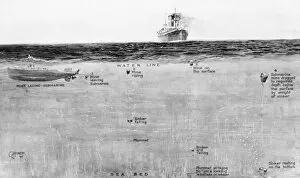
Mine laying submarine, WW1An illustration showing a mine-laying submarine during the First World War, and the different stages involved -- the mine leaving the submarine, the mine rising and reaching the surface
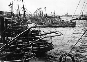
British drifters in harbour, Taranto, Italy, WW1British drifters which took part in the Otranto Barrage, an allied naval blockade in the Adriatic during the First World War, seen here at anchor in the harbour at Taranto, Italy
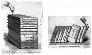
Stratification DiagramsTwo diagrams to explain stratification: the books represent the different stratas in a depth of about 5 miles; the hand indicates depth of the coal strata Date: 19th century
Patterned shapes - abstract painting by Raymond Sheppard
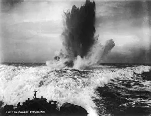
A Depth Charge ExplodingA ship under attack during the final conflicts of the sea war of the First World War - a depth charge explodes in the wake of a swiftly moving Royal Navy vessel
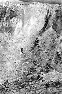
The crater of an exploded mineA photograph showing one side of a crater left by the detonation of a buried mine by the French army as part of the Somme offensive of 1916
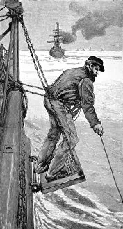
A Sailor Heaving the Lead, at sea, 1884Engraving showing a seaman, on the side of an emigrant ship, heaving the lead to check the depth of the water with a plumb line, 1884
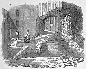
Roman pavement in Cannon StreetA Roman tesselated pavement discovered by workmen at a depth of 12 feet from the surface. The pavement, made up of tiles of red tesserae was without pattern
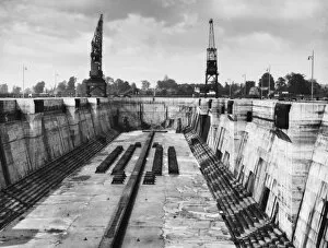
Southampton Docks 1940SKing George V Graving Dock at Southampton, England, 1, 200 feet long and 135 feet wide, with a depth of 50.5 feet to keel blocks
NILOMETERThe nilometer at Kihira - one of several measuring devices installed at various locations in Egypt to record the depth of the river
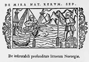
Unplumbable DepthsThe sea off the Norwegian coast is so deep that its depth cannot be measured by our plumb-lines
Russian Depth ChargeLaunching a depth charge from a Soviet Sea Hunter
Sailor / Heaving the LeadA sailor of the British navy heaves the lead to measure the depth of water in which the ship is sailing
Costume / Photo by WatsonMan: frock coat. Woman: jacket body, gauging & buttons on the cuff, ruff at the neck, draped tunic & a skirt with pleated flounces of varying depth & a very severe hairstyle
Titanic / Iceberg ScaleAn illustration showing the scale and depth of an iceberg in the region in which the Titanic sank