mail_outline sales@mediastorehouse.com
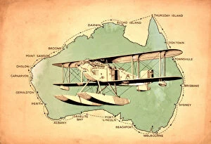
First circumnavigation of Australia by seaplane - 1924A map showing the route of the first circumnavigation of Australia by seaplane in 1924. On April 6, 1924, RAAF pilots Wing Commander Stanley James (Jimmy) Goble (1891-1948)
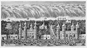
Mu and LemuriaThe submersion of MU - The great Pacific continent is overwhelmed by a combination of flood and volcanic action
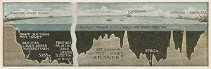
Atlantis Site ?Are the Azores, in mid- Atlantic, the site of the Atlantis continent ?
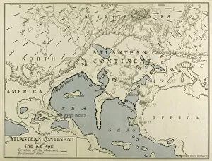
Atlantean Continent MapMap of the Atlantean Continent showing the extent of the Ice Age
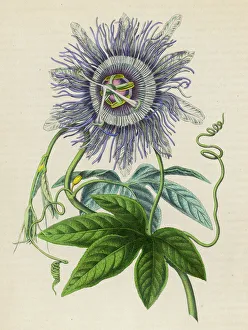
Passiflora -- Passion Flower -- brought from Peru/Brazil to Europe in 1699
Portolan atlas by Joan Martines (1556-1590). West CoastPortolan atlas of the world by Joan Martines (1556-1590). West Coast of the African Continent. Messina, 1587. National Library. Madrid. Spain
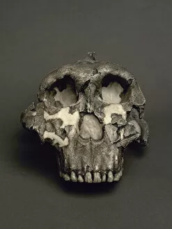
Cranium of Paranthropus boisei, named Dear Boy. 1, 8Reproduction of a Cranium of Paranthropus boisei, named Dear Boy. 1, 8 million years. From Olduvai Gorge, Tanzania. National Archaeological Museum. Madrid. Spain
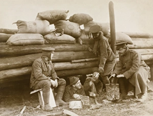
British soldiers resting behind a barricade on ContinentPhotograph: British soldiers resting behind a barricade on Continent.Shows five soldiers beside a wooden barricade topped with A.S.C. oat bags, through which one rifle is pointing
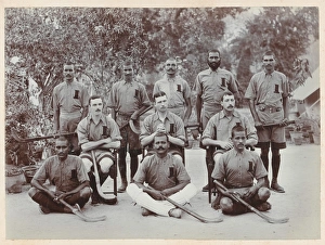
Regimental Hockey Team of the 1st BrahmansPhotograph: Regimental Hockey Team of the 1st Brahmans, 1910 (c).Sport was always important in the Indian Army. Hockey in particular was, and is, very popular in the Indian sub-continent
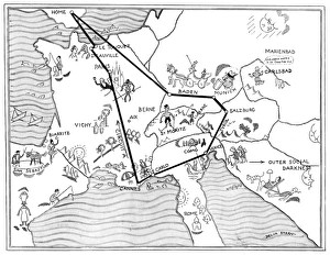
Social map of the ContinentA social map of the continent showing all the fashionable resorts during the 1930s including Biarritz, Monte Carlo, Cannes, Venice, Baden, Le Touquet, Deauville and St Mortiz. Date: 1934
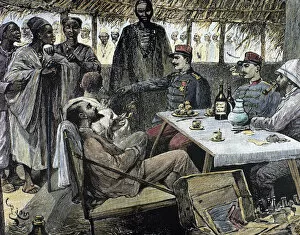
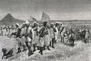
Stanley and his companions return from the expedition to theHenry Morton Stanley (1841-1904). British explorer. Stanley and his companions return from the expedition to the interior of Africa. Engraving. 19th century. Colored
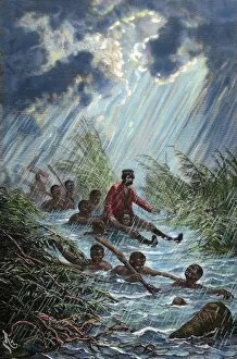
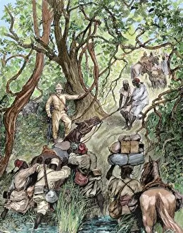
David Livingstone (1813-1873) through a swamp with a porterDavid Livingstone (1813-1873). Scottish explorer. Livingstone through a swamp with a porter during his expedition to Africa in 1872. Engraving by Charles Laplante (d.1903)
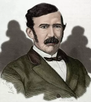
David Livingstone (1813-1873). Engraving. ColoredDavid Livingstone (1813-1873). Scottish explorer. Engraving in Weekly Familiar Picturesque, 1876. Colored
French expedition opens way into the Nieniya mountains, SudaAfrica. French expedition opens way into the Nieniya mountains, Sudan (January, 1893). Engraving. Colored
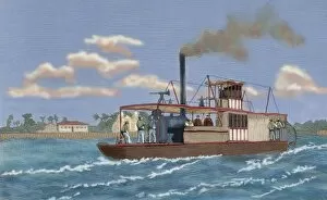
Portuguese gunboat commanded by Major Serpa Pinto, at the moPortugal. Portuguese gunboat commanded by Major Serpa Pinto, at the mouth of the Zambezi River. Used in the Anglo-Portuguese conflict: struggle of the Portuguese against the Makoldos
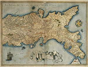
Map of the Kingdom of Naples. Theatrum Orbis Terrarum by Abraham Ortelius (1527-1598). First Edition. Antwerp, 1574. Library of Catalonia. Barcelona. Spain
China. Beijing. Forbidden City. Roof of a building in the interior
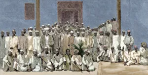
Head of an African tribe interviewing with the French. EngraFrench colonialism. Africa. Head of an African tribe interviewing with the French. Colored engraving. 19th century
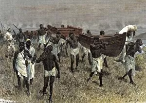
The porters of Lady Alice. EngravingHenry Morton Stanley (1841-1904). British journalist and explorer. African porters carrying sections of Lady Alice boat. Engraving in The Illustrated World, 1880
Map of the Iberian Peninsula. Theatrum Orbis Terrarum by Abraham Ortelius (1527-1598). First Edition. Antwerp, 1574
Map of African Continent. Theatrum Orbis Terrarum by Abraham Ortelius (1527-1598). First Edition. Antwerp, 1574. Library of Catalonia. Spain
Map of American Continent. Theatrum Orbis Terrarum by Abraham Ortelius (1527-1598). First Edition. Antwerp, 1574
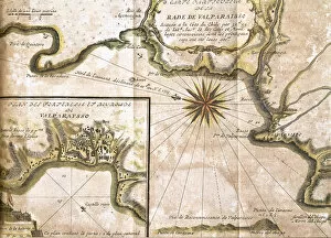
Chile. Valparaiso. Map in 1713 after an engraving of 1717
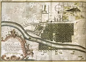
Chile. Santiago de Chile. Map in 1713 with Mount Santa Lucia, in the background. According to a 1717 engraving
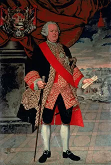
Manuel de Amat y Junient (1707-1782). Spanish military officer and colonial administrator. Royal governor of Chile and Viceroy of Peru. Portrait
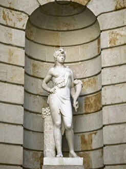
Spain. Barcelona. Statue of the Llotja representing Asia bySpain. Catalonia. Barcelona. Statue of the Llotja representing Asia by Francesc Bover (1769-1831). Neo-classicism. Sculptural group called the Four Continents
Spain. Barcelona. Statue of the Llotja representing Africa wSpain. Catalonia. Barcelona. Statue of the Llotja representing Africa was created by Manuel Oliver. Neo-classicism. Sculptural group called the Four Continents
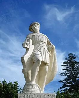
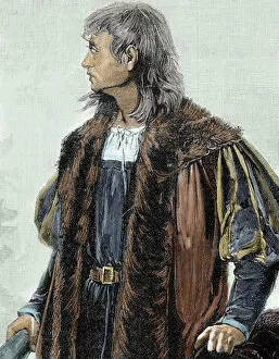
Martin Alonso Pinzon (1441-1493). Spanish navigator and explorer. Statue by A. Leon Ortega, 1977. Baiona. Galicia. Spain
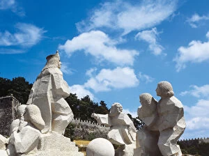
Encounter between two Worlds. Sculpture. SpainEncounter between two Worlds. Monument by Magin Picallo, 1993. Baiona. Galicia. Spain
Christopher Columbus (1451 -1506). Navigator, colonizer, and explorer. Colored engraving
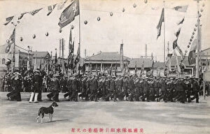
British Naval Continent in Japan - Anglo-Japanese AllianceBritish Naval Continent in Japan following the signing of the Anglo-Japanese Alliance of 1902. The Alliance was to run for five years before being renewed
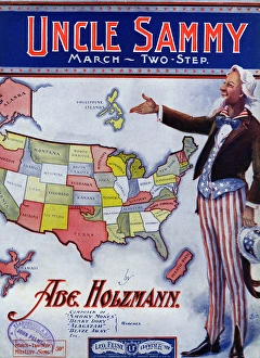
Music cover, Uncle Sammy March, Two Step, by Abe Holzmann. 1904
Egberg Borchgrevink - 2CARLSON EGBERG BORCHGREVINK Norwegian explorer, one of first to land on the Antarctic continent and the first to winter there. Date: 1864 - 1934
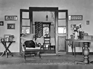
Indian Colonial InteriorInterior of colonial home in Indian sub-continent (probably Sri Lanka/Ceylon) Date: 1920
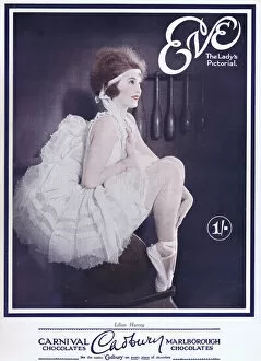
Cover of Eve Magazine 29 June 1927Portrait of Lilian Harvey, British born actress and singer attaining stardom on the continent mostly in German movies Date: 1927
Cartoon, Wife & No Wife, or, A trip to the Continent, by James Gillray. Showing the secret marriage believed to have taken place between the Prince of Wales (later George IV) and Mrs Fitzherbert
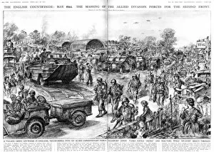
Allied Invasion forces gatherThe scene in an English village in May 1944, as the Allied forces gather in preparation for the invasion of the continent
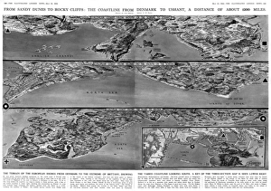
European coastline 1944A double page spread of The Illustrated London News, published less than a month before the Allied D-Day Normandy landings
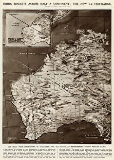
Rocket firing tests by G. H. DavisFiring rockets across half a continent: the new V2 test range. The UK-Australian experimental guided missiles range, with 1200 miles from firing point to coastline
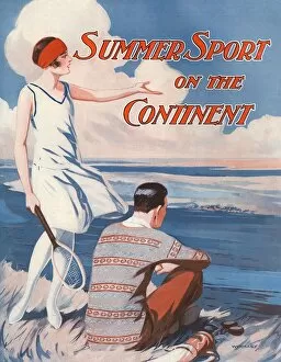
Summer sport on the ContinentSupplement cover of the Illustrated Sporting and Dramatic News, reporting on the sporting possibilities on the Continent. A young woman in tennis costume points across the Channel while her male
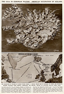
American occupation of Iceland by G. H. DavisThe USA in European waters: American occupation of Iceland during the Second World War. A detailed relief map of Iceland, its fjords and mountains, showing distances from America
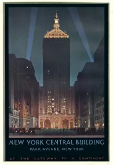
Poster design, New York Central Station building, Park Avenue, at the gateway to a continent. Date: 20th century
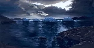
Proterozoic Ice Age
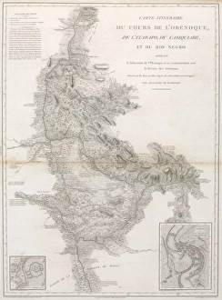
Du cours de l OrenoquePlate 16 from Atlas Geographique et Physique du Nouveau Continent (1814) by Al. de Humboldt
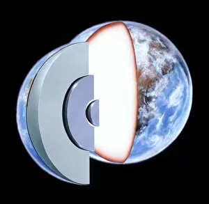
Diagram showing the Earths interiorCrust - continents 35km, oceans 6km. Mantle - peridotite 2900km. Outer core - iron (liquid) 2000km. Inner core - iron (solid) 1370km
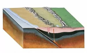
Subduction zoneAn illustration of a subduction zone at work beneath the South American continent. Fig 20 from The Story of the Earth 1977, London
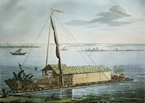
Raft of the Guayaquil seaside. Picture of the" Raft of the Guayaquil seaside. Picture of the work by Alexander von Humboldt " Voyage aux regions 鱵 inoxiales du Nouveau Continent" (Strasbourg, 1805). Engraving. ECUADOR
Stanley, Sir Henry Morton (1841-1904). Through" Stanley, Sir Henry Morton (1841-1904). " Through "