mail_outline sales@mediastorehouse.com
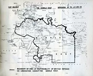
Middle East defence mapBritish defence of the Middle East, top secret plan, 1949 Date: 1949
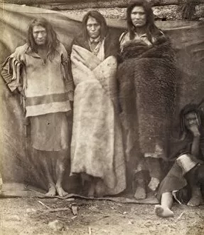
Group of Native Americans, three standing, one seated on the ground, possibly Colville or Kutenai, at the winter quarters of the British Northwest Boundary Commission Survey in Colville, Washington
Cutting the boundary line. Photograph shows several men of the British North American Boundary Commission survey crew posed in clearing, with transit
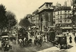
Paris Porte St MartinTraffic was as heavy on Les Grands Boulevards in 1904 as it is a century later : the Porte Saint-Martin marks the boundary of the old city. Date: circa 1904
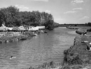
Thames at RadcotA glimpse of the River Thames at Radcot, where it flows through pleasant meadows and forms the boundary between Berkshire and Oxfordshire, England. Date: 1950s
The Prince of Wales at the Khyber PassEdward, Prince of Wales (later to become King Edward VIII) leaving the Khyber Pass during his world tour in 1921-2. Date: circa 1922
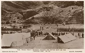
Trade Treaty between British and Afghan GovernmentsNorth West Frontier Province - Trade Treaty between British and Afghan Governments at the Frontier Post. The card shows a picket of Afghan infantry (on the left) and Britsih Infantry (on the right)
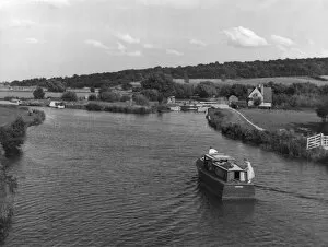
Boating on the ThamesBoating on a pleasant stretch of the River Thames, viewed from Swinford Bridge, where it forms the boundary between the counties of Oxfordshire and Berkshire, England. Date: 1930s
Woodland TrackwayThe sunken trackway approaching Goldings Wood, Hertfordshire, England, which acts as a parish boundary between Great Amwell and Stanstead St. Margaret s. Date: 1930s
Glencoyne Farm, dating from 1629, at Ullswater, on the boundary of Westmorland with Cumberland (Cumbria), England. Date: 17th century
Boundary House, Wellington Terrace (opposite Kensington Gardens), London. One of Londons smallest houses, on the boundary between Kensington and Paddington. Date: 19th century
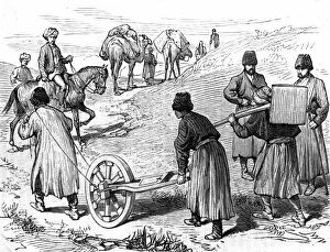
Surveying in AfghanistanA mile-measuring machine (perambulator) being used by the Afghan Boundary Commission. Date: circa 1884
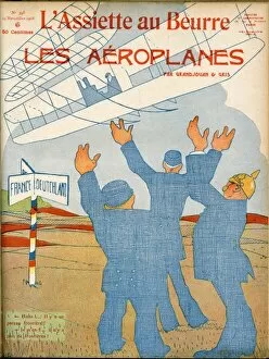
Flight - No more bordersThe turn of the twentieth century heralds the new age of flight, and a world of no borders or boundaries
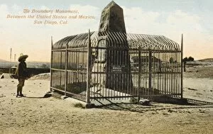
Boundary Monument between USA and Mexico - TijuanaA Boundary Monument between the United States and Mexico at San Diego, California, USA. The monuments erected by the boundary survey played a pivotal role in securing the line after
Boundary Monument between USA and MexicoA Boundary Monument between the United States and Mexico at San Diego, California, USA. The monuments erected by the boundary survey played a pivotal role in securing the line after
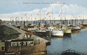
Sault Ste Marie, Ontario, CanadaCargo steamers await the opening of Navigation at Sault Sainte Marie, Ontario, Canada. The name of two cities on the Saint Marys River
Border Marker between Mexico and USABorder marker between the United States of America and Mexico. Eight jolly Americans (on a Kozy Kar Tour!) pose in Mexican attire of ponchos and sombreros in front of the marker
American Indians. On the outskirts of the campSioux brave defending the boundary of the camp with a bow and arrow
The Border between the United States and British Columbia, cPanorama showing part of the boundary line between the United States and British Columbia, with Mount Baker in the background
American Indians. Boundary Post between the United States amCree Indians living near Lake Winnipeg, were involved in this border dispute between the British in Canada and the Americans
England / Lichfield 1785View near Lichfield (Staffordshire) " including a most remarkably large willow tree"
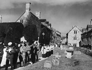
Clipping the YewsClipping the famous yew trees at Painswick Church, Gloucestershire, England. Here the band, congregation and procession walk around the churchyard boundary
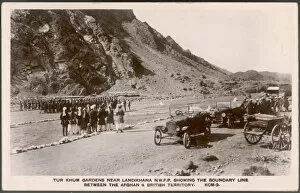
Border AfghanistanTur Khum Gardens near Landikhana, North West Frontier Province, showing the boundary line between the Afghan and British territory