mail_outline sales@mediastorehouse.com
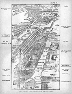
Map of the Pall Mall area of LondonMap of the Charing Cross, Pall Mall and Pimlico area of central London showing, the famous thoroughfare of Pall Mall with its numerous club houses
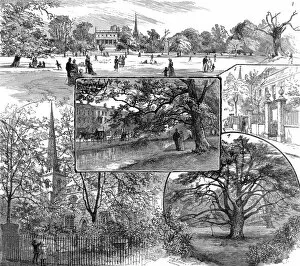
Clissold Park, Stoke Newington, London, 1885Engraving showing a series of scenes of Clissold Park and the surrounding area, 1885. The images show (clockwise from top): Horse-Shoe Field; Church Street; Old Yew Tree; the Old Church
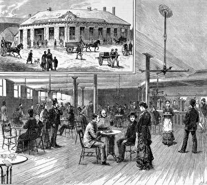
The new coffee tavern at BradfordInterior and exterior views of the new coffee tavern in Bradford, inaugurated by W. E Forster, M.P in 1879. The Coffee Tavern movement was a Victorian effort to get people out of pubs
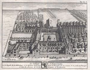
Emmanuel College 1690A bird s-eye view of the college showing the chapel, dining hall, library, the Deans lodgings, gardens, brewery, kitchen & an area for real- tennis or le jeu de paume
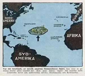
Bermuda Triangle / MapThe area already had a sinister reputation even before the triangle was invented - wrecks were thought to end up in the Sargasso Sea
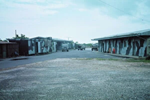
Foxy-Golf at BelizeFoxy-Golf hide domestic area looking from the entrance gate. Bar to extreme left and accommodation to the right Date: 1990
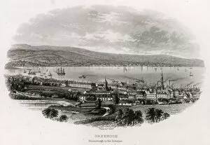
Greenock, Renfrewshire, ScotlandGreenock is a town and administrative centre in the Inverclyde council area in Scotland and a former burgh within the historic county of Renfrewshire
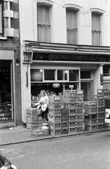
Soho, London - 26 Frith Street W1 - Oxford Express Dairy (Welsh Dairy). 1973
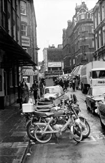
Soho, London - Rupert Street W1, looking towards Brewer Street and Isows Restaurant. 1973
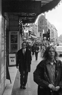
Soho, London - Shaftesbury Avenue W1, outside the Apollo Theatre. 1973
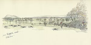
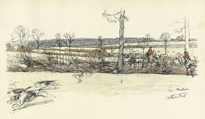
Peckforton Wood, in the Cheshire Hunt areaView of Peckforton Wood, in the Cheshire Hunt area, with a hunt in progress. Date: 1936
Between Red Mile and Belvoir, with Belvoir CastleView of the countryside between Red Mile and Belvoir, with Belvoir Castle in the distance, an area popular with the Belvoir Hunt, Leicestershire. Date: 1936
Castle Milk, LockerbieCastle Milk, near Lockerbie, Dumfriesshire. The house was one of several in the area used by Barnardos as an evacuation home during the Second World War
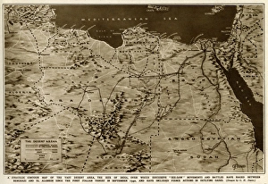
Map of the war in North Africa by G. H. DavisThe war in North Africa: a strategic contour map of the desert arena during the Second World War. Conflict began there in September 1940. Date: 1942
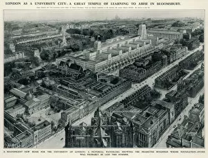
University of LondonA panorama of the Bloomsbury area of London showing how Senate House, designed by Charles Holden, will fit in with the other University of London buildings
Athelney in Somerset, the most flooded village in EnglandAthelney in Somerset, devastated by floods in 1930 showing the only method of travel around the area - in Venetian style, by boat
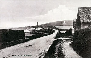
The Watlington White Mark, Oxfordshire. The chalk scar was dug into Watlington Hill in 1764 to give the illusion that the town's church had a spire
Dennis Skinner, Labour MP for Bolsover, DerbyshireDennis Edward Skinner (b 1932), Labour politician, MP for Bolsover since 1970. Well known for his outspoken remarks in parliament, for which he has been suspended more than ten times
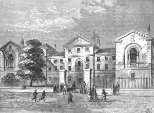
Middlesex HospitalA view of the Middlesex Hospital in 1840. Middlesex Hospital was a teaching hospital located in the Fitzrovia area of London, England
Great Eastern Railways Locomotive works at StratfordA view along the north side of the Great Eastern Railway?s Locomotive works at Stratford (East London) May 1864 with William Henry Maw, then Head of the Drawing office
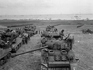
Tanks of the 3rd and 4th SharpshooterPhotograph: Tanks of the 3rd and 4th Sharpshooters in the de-waterproofing area. Shows two lines of tanks with the sea in the background
Soho, London - 52-53 Broadwick Street W1 - man pulling a barrow. 1973
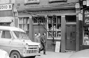
Soho, London - 20 Greek Street W1 - Hopkins Purvis & Sons Ltd, paint merchants. 1973
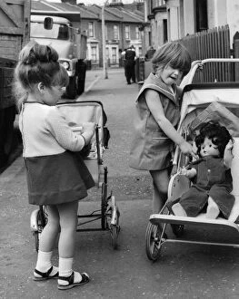
Girls with dolls and prams, Balham, SW LondonTwo little girls with dolls and prams on a Balham street, SW London. Date: circa 1961
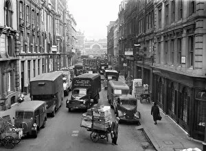
Traffic congestion, Covent Garden, London WC2Traffic congestion in the Covent Garden area, London WC2, showing a view along Henrietta Street from the corner of Bedford Street during the morning of 26 March 1959
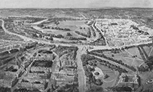
Birds-eye view of the Social London, 1914An aerial view of the two prestigious, social areas of London - Mayfair and Belgravia. In the foreground is Belgravia with its eastern frontier running down from Grosvenor Place
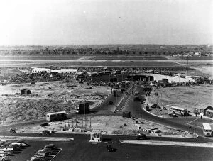
The central area at Heathrow Airport c 1955The central area at Heathrow Airport, circa 1955. Date: 1955
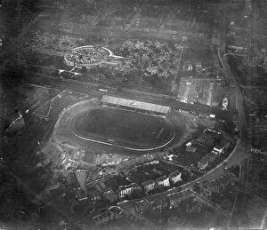
Aerial view North of Fulham Road near Stamford BridgeThis view is one taken in a north easterly direction and illustrates the region to the north of Fulham Road near the Stamford Bridge football ground
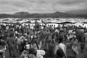
CONGO, Democratic Republic of the. NORTH KIVU. Democratic Republic of the Congo (2008). Kivu Conflict. Refugee camp of Mugunga I (20000 people), the oldest of the area. General view
MODERN OFFICE BLOCKSModern office blocks, built in the London Wall area of the City of London, after the World War Two Blitz. Date: 1960s
Aerial photograph of Bayernschloss, Germany, WW1Aerial photograph (German) of an area described as Bayernschloss, Germany, during the First World War. Date: 12 July 1917
Gardens at Tewin, HertfordshireView of gardens at the village of Tewin, near Welwyn Garden City, Hertfordshire, showing many shades of tulips growing in an open, grassy area
Cranbourne Street, London, 1845Engraving showing Cranbourne Street, London, in 1845, shortly after a number of improvements to the area
A Fish Auction in Columbia MarketIn 1869 Baroness Burdett-Coutts paid for the building of the great Columbia Market (for fish) between Hackney and Bethnal Green Roads on the site of Nova Scotia Gardens
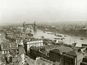
London / Tower Bridge AreaTower Bridge area
Burnham Beeches, BucksA woodland area near Slough, Berkshire, famed for its magnificent beech and other trees : a countrywoman and her dog are collecting firewood
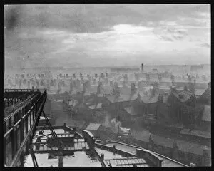
Grim GrimsbyA Humber storm breaking over the dock area at Grimsby, Lincolnshire, England. Note the rows of little back-to- back houses, interspersed with small industrial premises
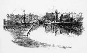
Maida Hill Tunnel, Regents Canal, Little Venice 1885Maida Hill Tunnel on the Regents Canal in 1885, Little Venice area of London Date: 1885
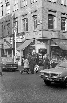
Soho, London - Frith Street and Old Compton Street W1Soho, London - corner of Frith Street and Old Compton Street W1 - Continental Groceries. 1973
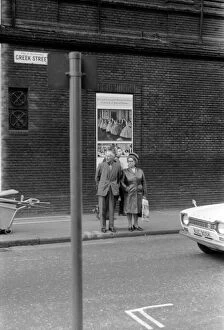
Soho, London - Greek Street W1 - a middle-aged couple about to cross the road. 1973
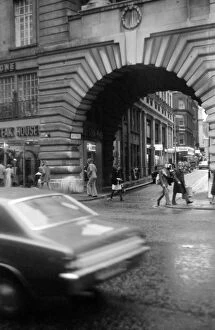
Soho, London - Regent Street W1 - looking towards Air Street. 1973
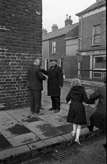
Two men chatting, Falls Road, Belfast, Northern IrelandTwo men chatting on a corner in the Falls Road area of Belfast, Northern Ireland. Date: 1969
Sutton Ambion, Atherstone Hunt area, LeicestershireView of Sutton Ambion, Leicestershire, in the Atherstone Hunt area, with a hunt in progress. Date: 1936
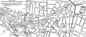
Sketch map of proposed improvements, BirminghamSketch map of a locality around Stafford Street in Birmingham with the proposed new street running through it. The boundary of the unhealthy area referred to in the Birmingham Improvement Scheme as
Syracuse, Italy - The Greek TheatreSyracuse, Italy (Siracusa) - The Greek Theatre with the cty in the distance. The cavea (seating area) is one of the largest ever built by the ancient Greeks: it has 67 rows
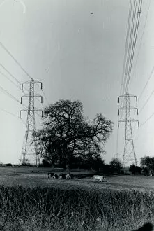
Cows and Pylons, York Area, Yorkshire, England. Date: 1970s
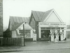
Old Baptist Church - Black and white lantern slide. Old church converted to petrol station.. Part of Box 399. Boswell Collection. Date: circa 1900
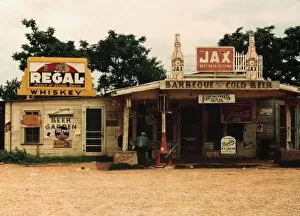
A cross roads store, bar, juke joint, and gas station in the cotton plantation area, Melrose, La. Photograph shows Sign on left building: Frenchies Beer Garden; above porch: Frenchies Bar